Engineering services

PLANNING SERVICES

Snipes-Dye associates provides civil engineering and planning support to a wide range of projects. Beginning with project inception, we identify project constraints and opportunities then translate that information into practical engineering solutions. We also provide full entitlement application preparation and processing including public hearing support.

  • Due Diligence
  • Development Feasibility
  • Master Planning
  • Site Layout
  • Subdivision Preliminary Planning
  • Infrastructure Planning
  • Tentative Parcel Maps
  • Slope Analysis
  • Tentative Maps
  • Agency Research and Permitting Feasibility
  • Entitlement Processing
  • EIR Technical Support
  • Schematic Grading Design
  • Use Permits

PUBLIC INFRASTRUCTURE SERVICES

Snipes-Dye associates provides civil engineering design and construction documents for public agencies throughout the region including cities, counties and public utility agencies. We are sensitive to agency budgets and work closely to develop cost-effective solutions that meet the goals and objectives of the project.

  • Streets and Roadways
  • Storm Drainage
  • Water Supply and Distribution
  • Sewer Collection
  • Pedestrian Accessibility
  • Parking Lots
  • Parks
  • Energy and Communications Utilities
  • Existing Utility Location and Mapping

SITE DEVELOPMENT SERVICES

Snipes-Dye associates provides a full range of site and land development services. We provide fully integrated solutions that account for our clientÂ’s goals, agency requirements while considering the physical opportunities and constraints of the property. We provide technical expertise and navigate our client through the initial survey of the property, definition of the project, interpretation of agency requirements, preparation of permit documents, processing for approvals and construction administration.

  • Mass and Precise Grading
  • Stormwater Management
  • Flood Protection
  • Watercourse Configuration
  • Water Supply and Distribution
  • Water Pumping
  • Sewage Collection
  • Sewage Pumping
  • Surface Improvements
  • Erosion Control
  • Energy and Communication
  • Accessibility Hardscape and Parking
  • Agency Permitting
  • Quantity Takeoffs
  • Public Agency Bond Estimates
  • Preliminary Cost Opinions
  • Earthwork
  • Construction Administration

STORMWATER MANAGEMENT SERVICES

Snipes-Dye associates provides stormwater management design and compliance documents for in-house projects, as well as projects designed by others. Stormwater management is a complex and highly regulated specialty within civil engineering that includes treatment, detention, retention and hydromodification. Our engineers are also Qualified SWPPP Developers and Practitioners.

  • Initial Project Regulatory Assessments
  • Preliminary Design
  • Engineering Compliance Design
  • Hydromodification Design
  • Low Impact Development Facilities
  • SWPPP Design and Documentation
  • SMARTS Filings
  • SWPPP Addendums
  • Stormwater Quality Management Plans (SWQMP)
  • Water Pollution Control Plans (WPCP)

LAND SURVEYING services

TOPOGRAPHIC SURVEYS AND MAPPING SERVICES

Topographic surveys are required by many local government bodies to determine the existing conditions and elevations of a site. Together with a boundary survey, topographic surveys are used by architects and engineers to create accurate and appropriate designs based on existing conditions. Topographic surveys may be required as part of real estate transactions, civil engineering design and construction projects, including:

  • New construction
  • Remodeling projects to existing structures
  • Utility design
  • Road or bridge design or improvements
  • Grading or drainage projects
  • Planning Services
  • Aerial Video

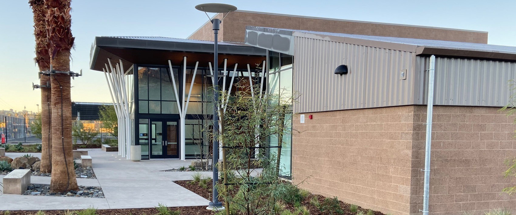
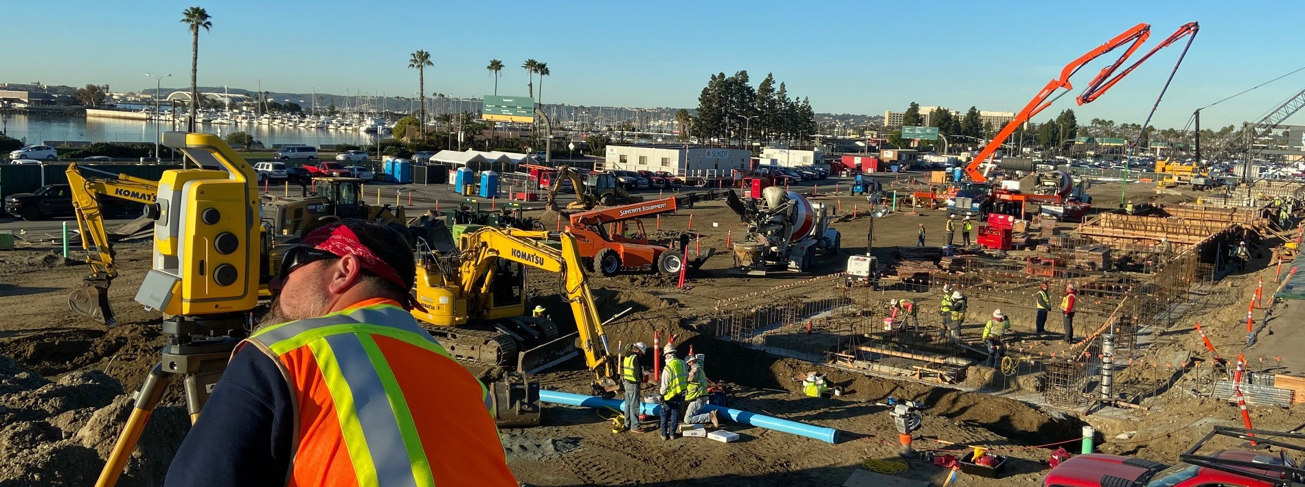
CONSTRUCTION STAKING SERVICES

Construction staking involves the surveying and staking for various stages of construction, and can involve staking specific elements for roadways, bridges, buildings, and utilities. These elements can include curb and gutter, centerlines and base lines of roadways, building corners, storm and sewer lines, and a multitude of others items.


BOUNDARY AND PROPERTY LINE SURVEY SERVICES

A boundary survey is a process carried out to determine property lines and define true property corners of a parcel of land described in a deed or map. It can also indicate the extent of any easements (if accompanied by a title report) or encroachments. Easements may include a utility line easement crossing the subject property to a neighboring property or appurtenant like the right to cross another property for access to a public road. Boundary surveys are an important procedure for anyone buying a property of any type. They are typically performed prior to buying, subdividing, improving or building on land. Surveying the parcel before these activities ensures avoidance of future disputes, the expense and frustration of defending a lawsuit, moving a building, or resolving a boundary problem.


ADDITIONAL SURVEY SERVICES

Snipes-Dye associates provides additional survey services for all of your professional or personal needs including:

  • ALTA Surveys
  • Route Surveys
  • Control Surveys
  • Corner Records
  • GPS
  • Surveys for Traffic Signalization
  • Test Boring Location Surveys
  • Lot and Building Stakeout
  • Grading Certifications
  • As-Built Surveys
  • Legal Descriptions & Exhibits
  • Record Plats
  • Well and Septic Stakeout
  • Subdivision Maps
  • Subdivision Maps
  • Condominium Plans
  • Parcel Maps
  • Monitoring Surveys
  • Record of Surveys
  • Aerial Photogrammetry Surveys
  • Utility Mark-Out Surveys
  • Pothole Locating